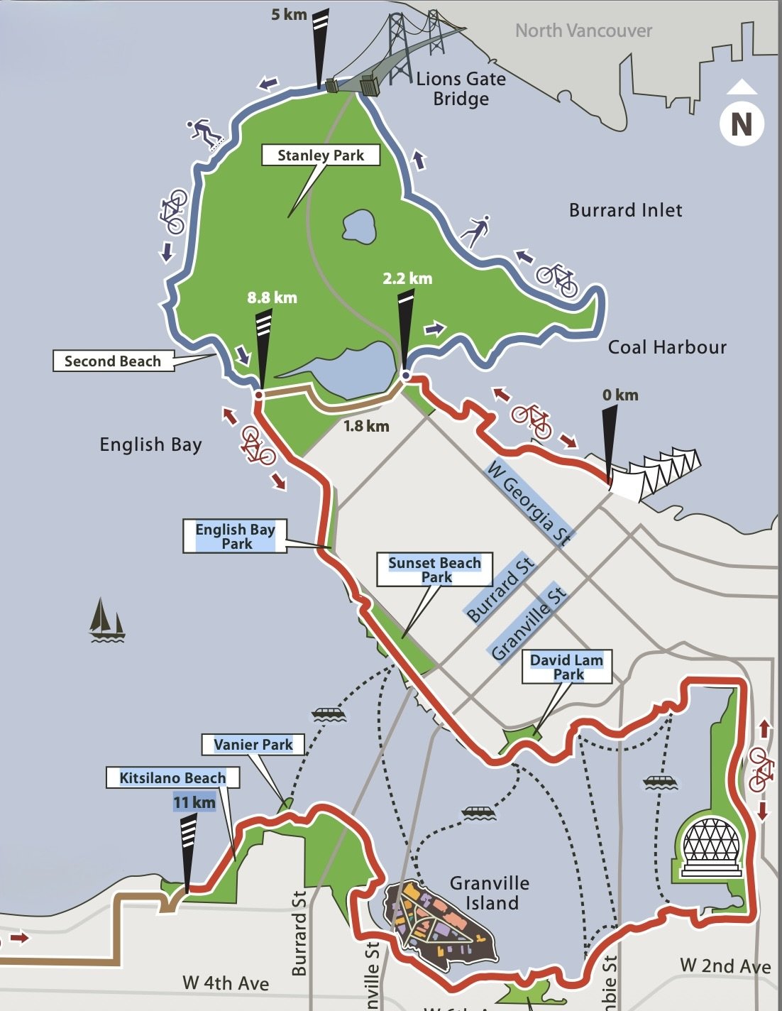
Vancouver Seawall
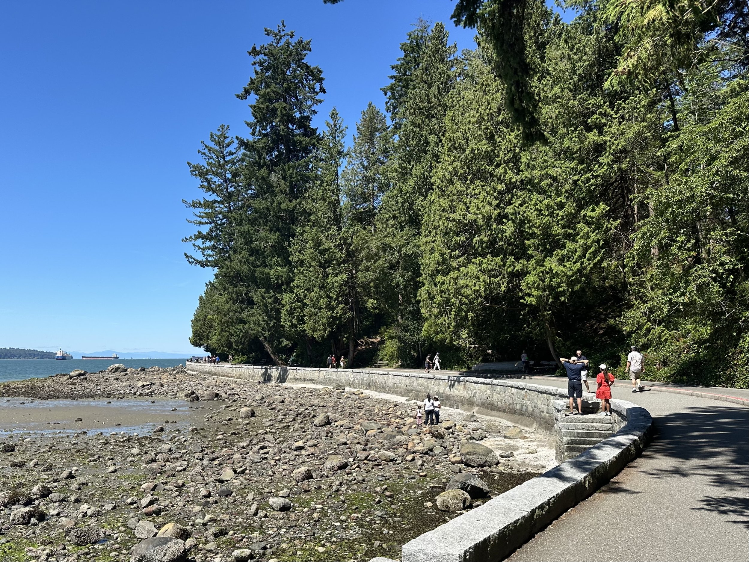
Downtown Vancouver is a peninsula, with Stanley Park occupying 1,000 acres at its tip. The Seawall runs the full length of the peninsula shoreline and beyond, about 28 kilometers (17.4 miles) in total. It’s the world's longest uninterrupted waterfront path.
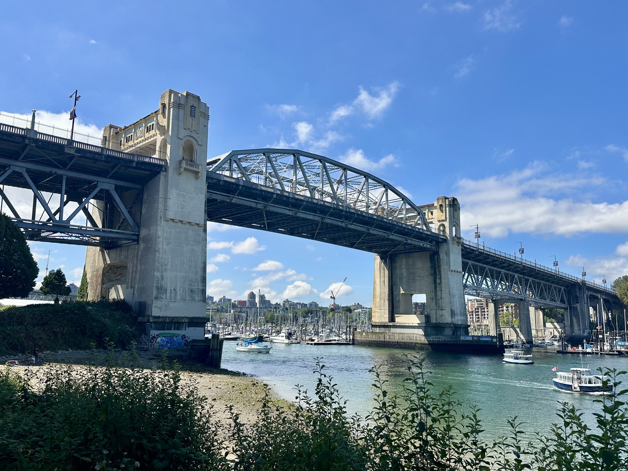
It was sunny and 75℉ with a light, cool breeze - a perfect day to be outdoors. So we decided to walk the Seawall, starting from near our apartment at the Burrard Bridge and going all the way around Stanley Park to Coal Harbor, a distance of 10-12 km (6.5-7.5 mi).
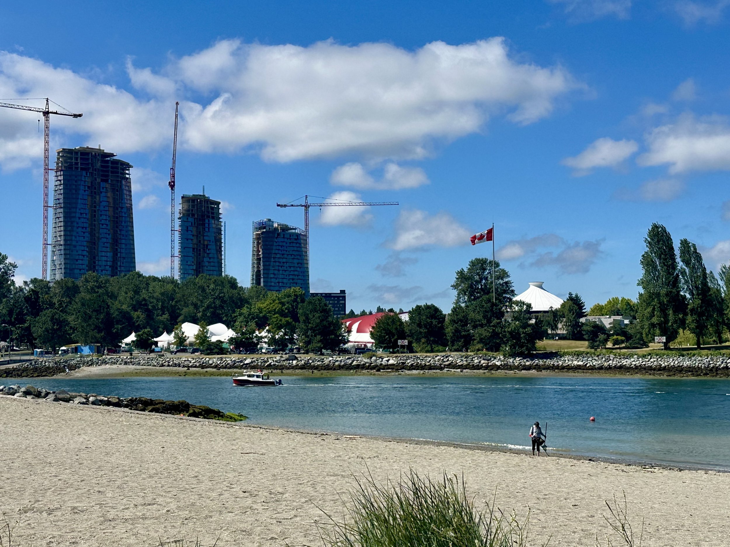
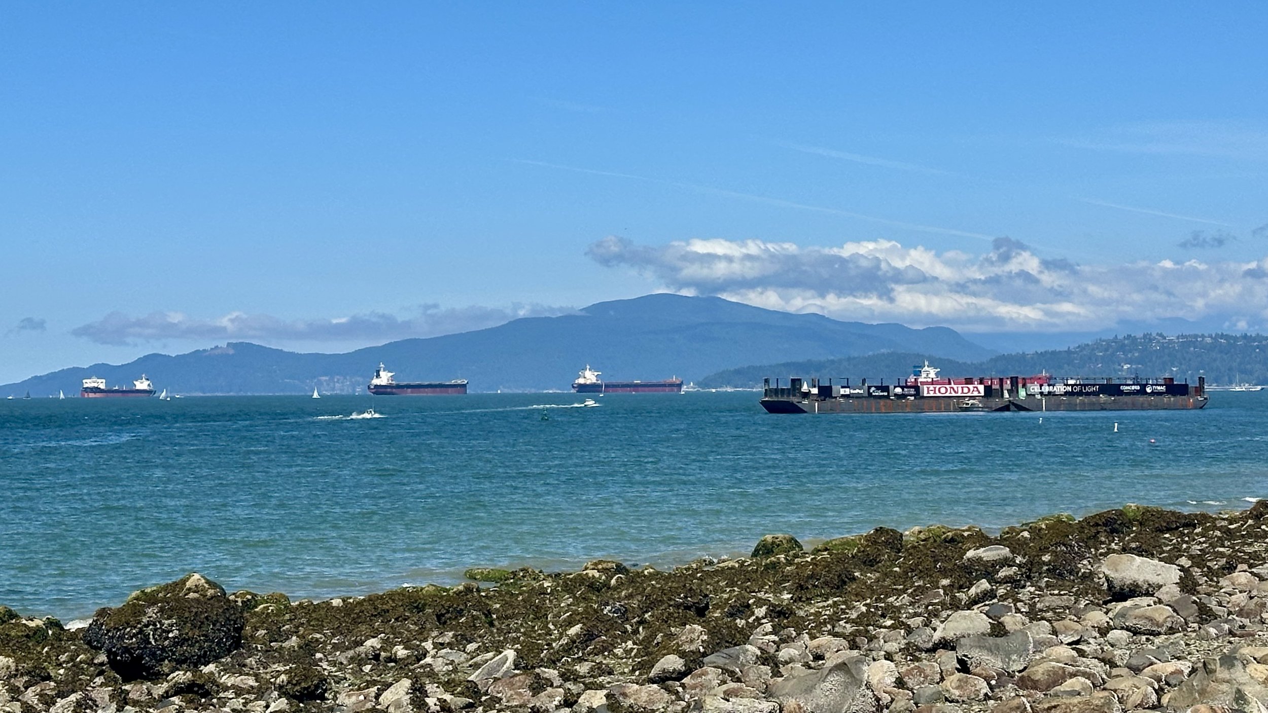
The first portion of the Seawall went northwest, along False Creek. Across the water, we could see the distinctive Modernist roof of the planetarium at the space center in Vanier Park. It was low tide, and the wide beach was soon replaced by wide swaths of rocks and moss at English Bay. There was a fleet of what looked like unloaded container ships sitting in the bay, and we soon realized they were barges preparing for Celebration of Light, the annual fireworks festival and competition that would start the following week. It sounded fun - maybe we’ll see the fireworks on a future visit to Vancouver.
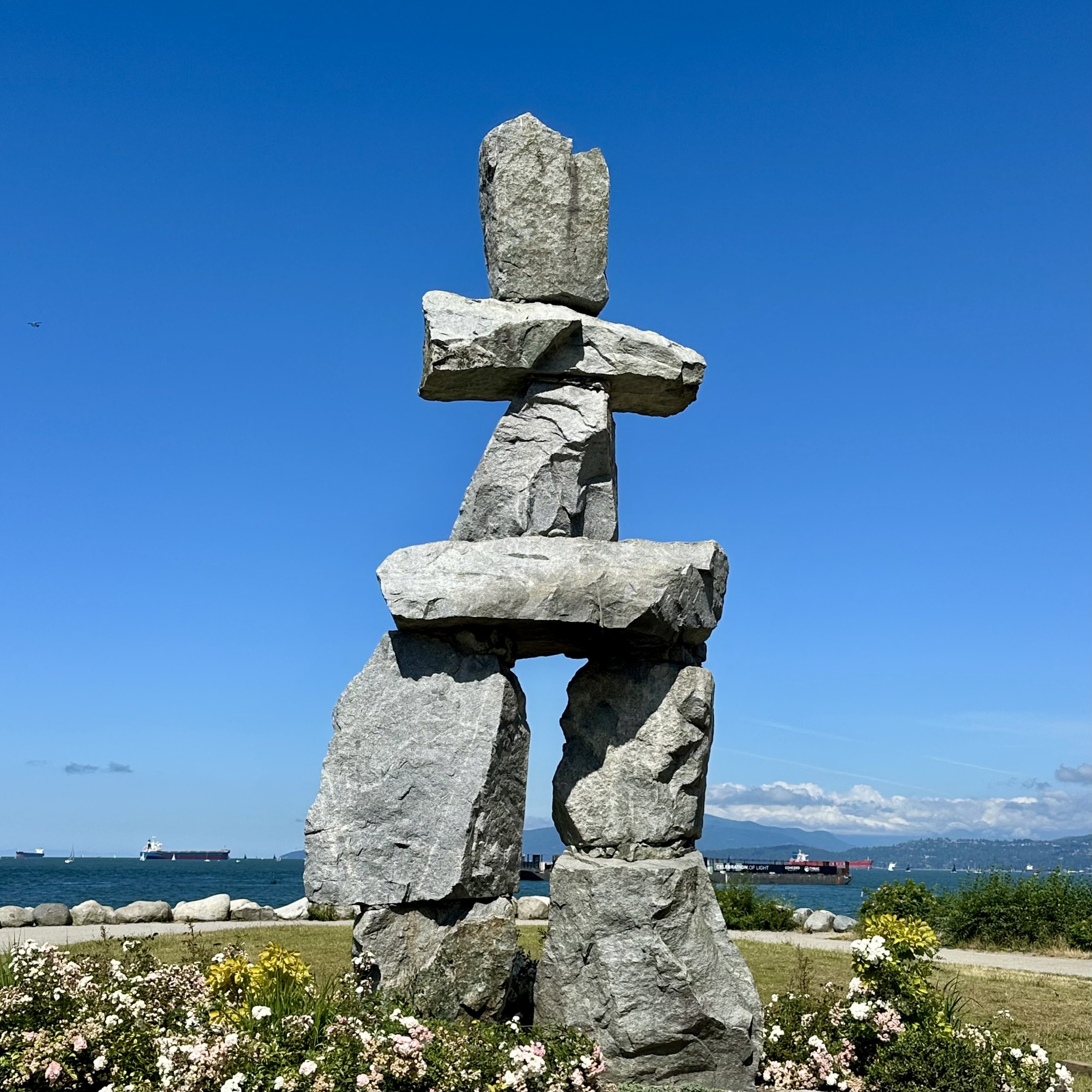
English Bay was also the site of Inukshuk, the 20-foot-tall granite monument by Alvin Kanak that was created for the 1986 World Expo. The plaque read, “This ancient symbol of the Inuit culture is traditionally used as a landmark and navigational aid and also represents northern hospitality and friendship.”
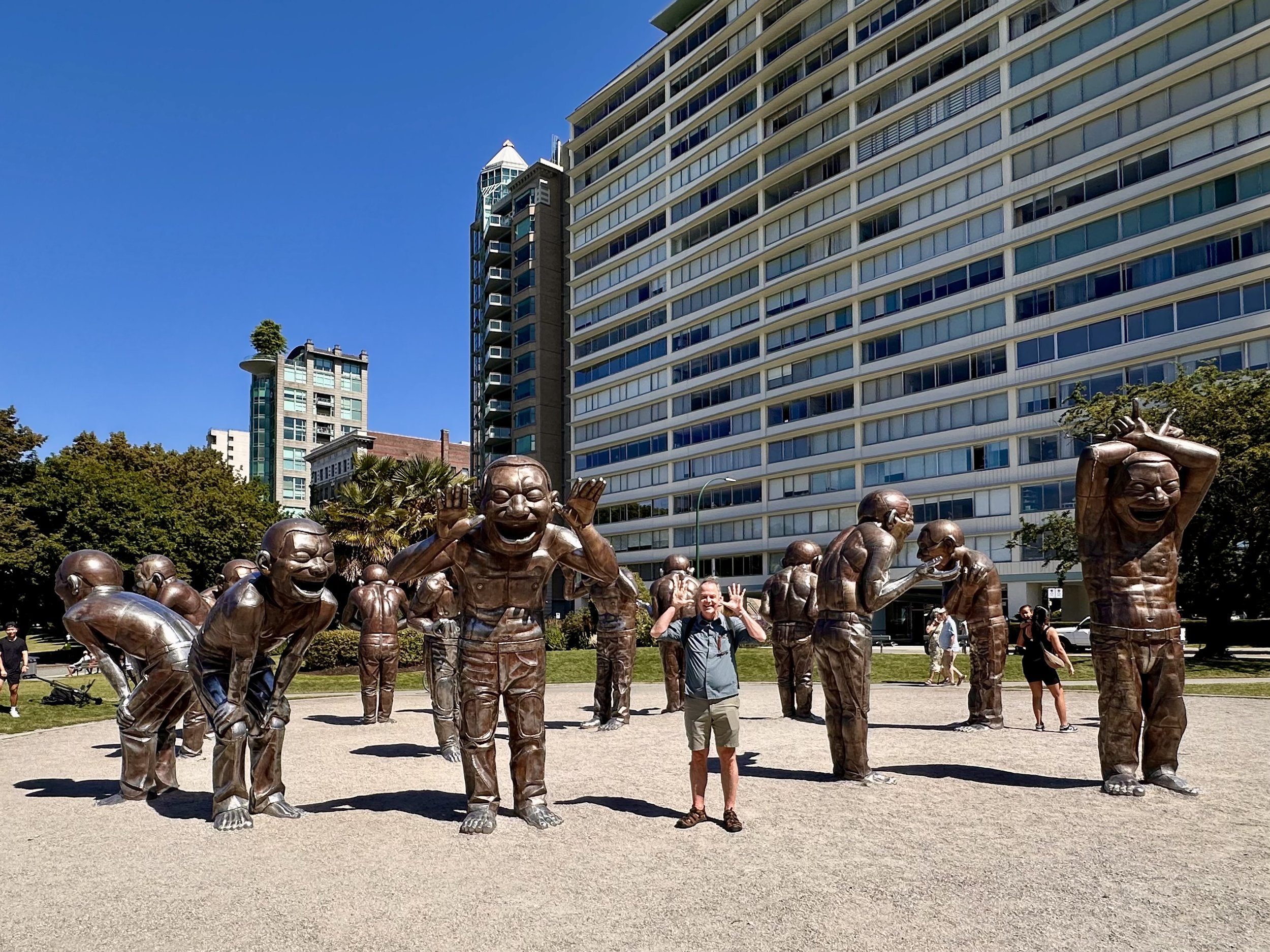
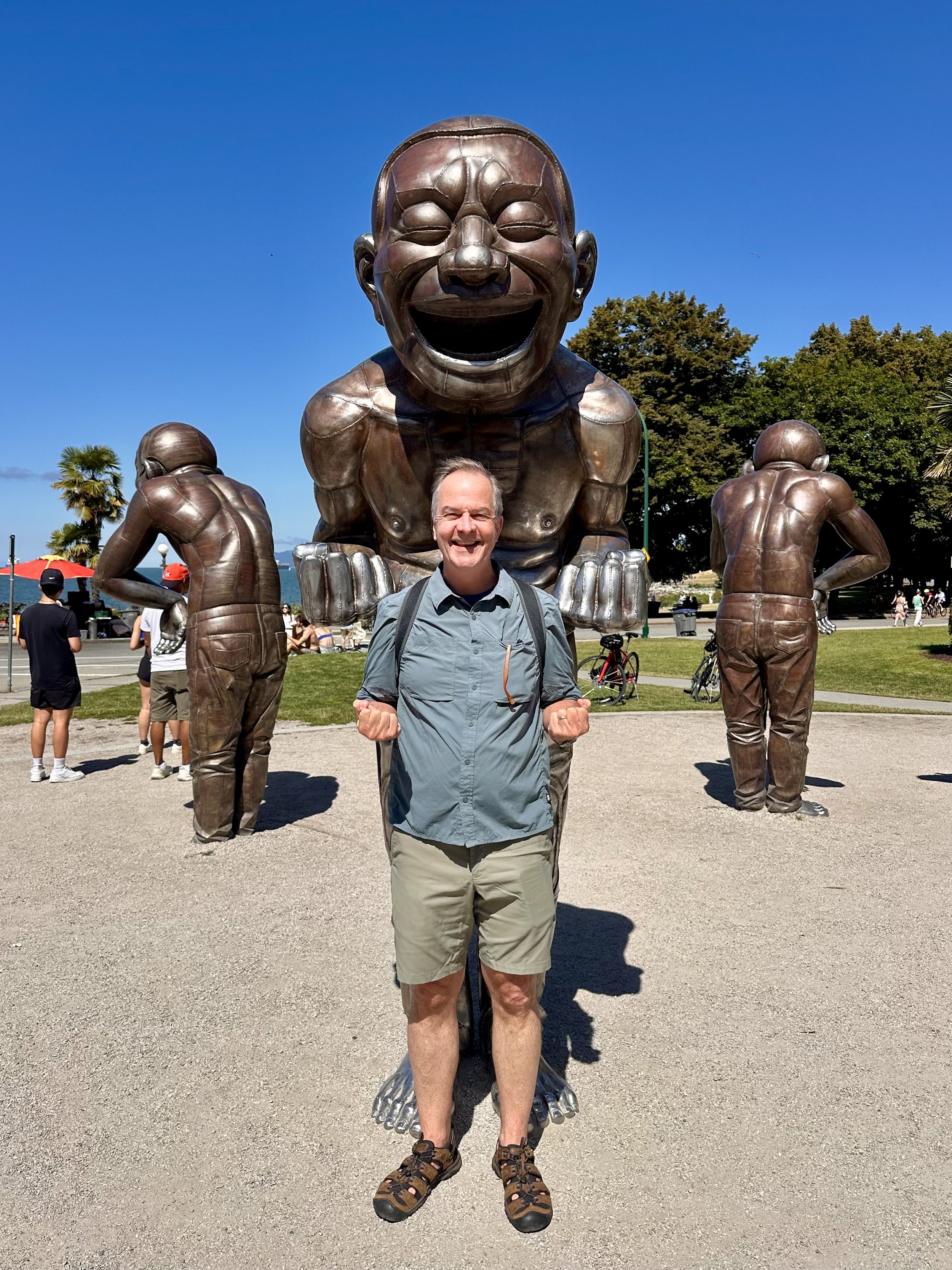
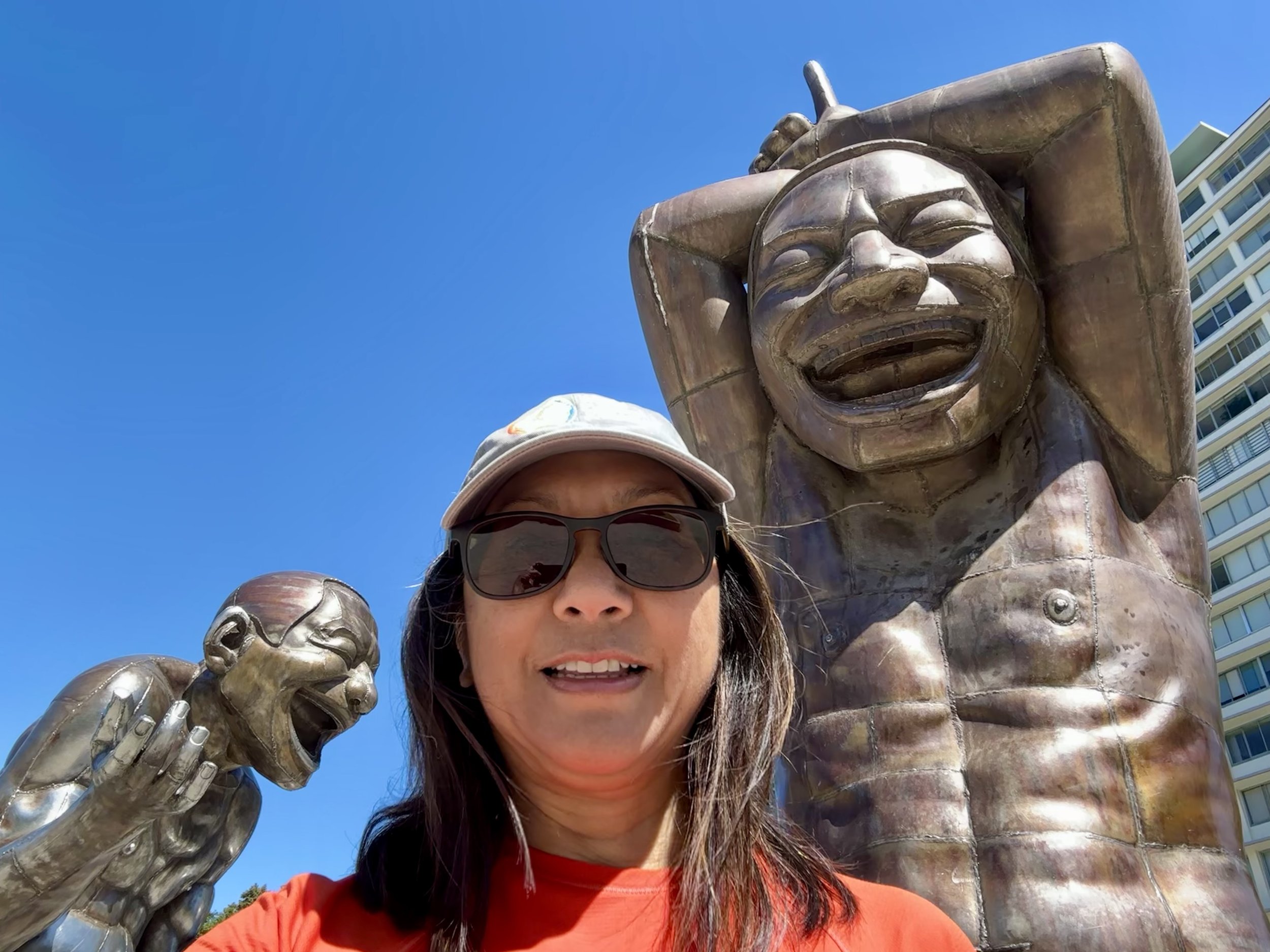
We took a very short detour from the Seawall to see A-maze-ing Laughter, a public sculpture by Chinese artist Yue Minjun. The fourteen laughing figures were nearly ten feet tall, and were the artists’ self-portraits. They were a modern take on the 18th century Character Heads that we had seen in Vienna. On a nearby curved bench was inscribed, “May this sculpture inspire laughter playfulness and joy in all who experience it.”
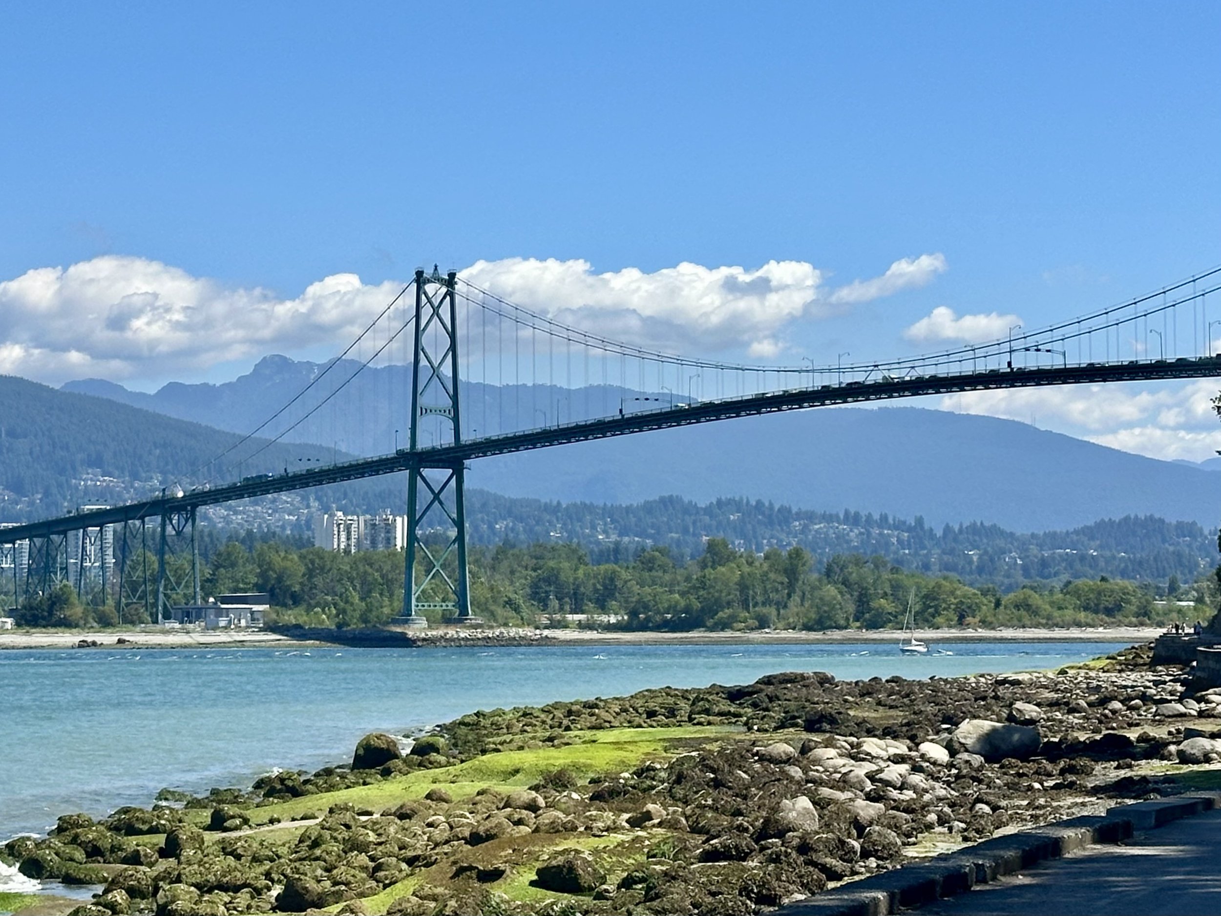
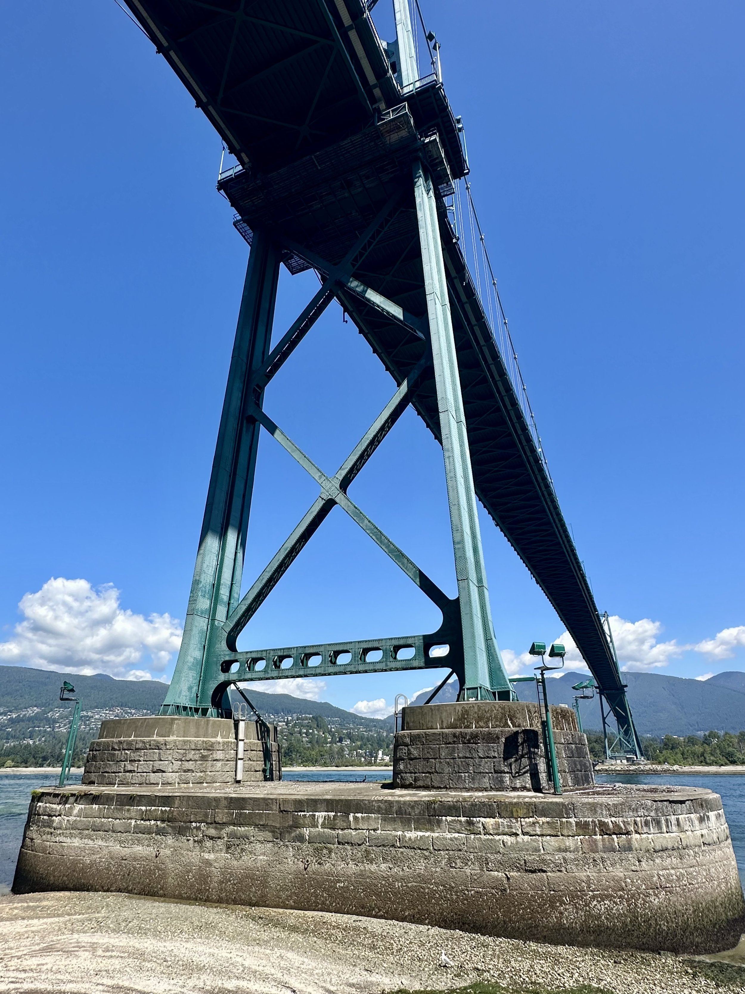
We had reached Stanley Park, and the Seawall continued around it. The park was actually high above the pathway; all we could see was the bare cliffside. At the very tip of the peninsula was the Lions Gate Bridge.
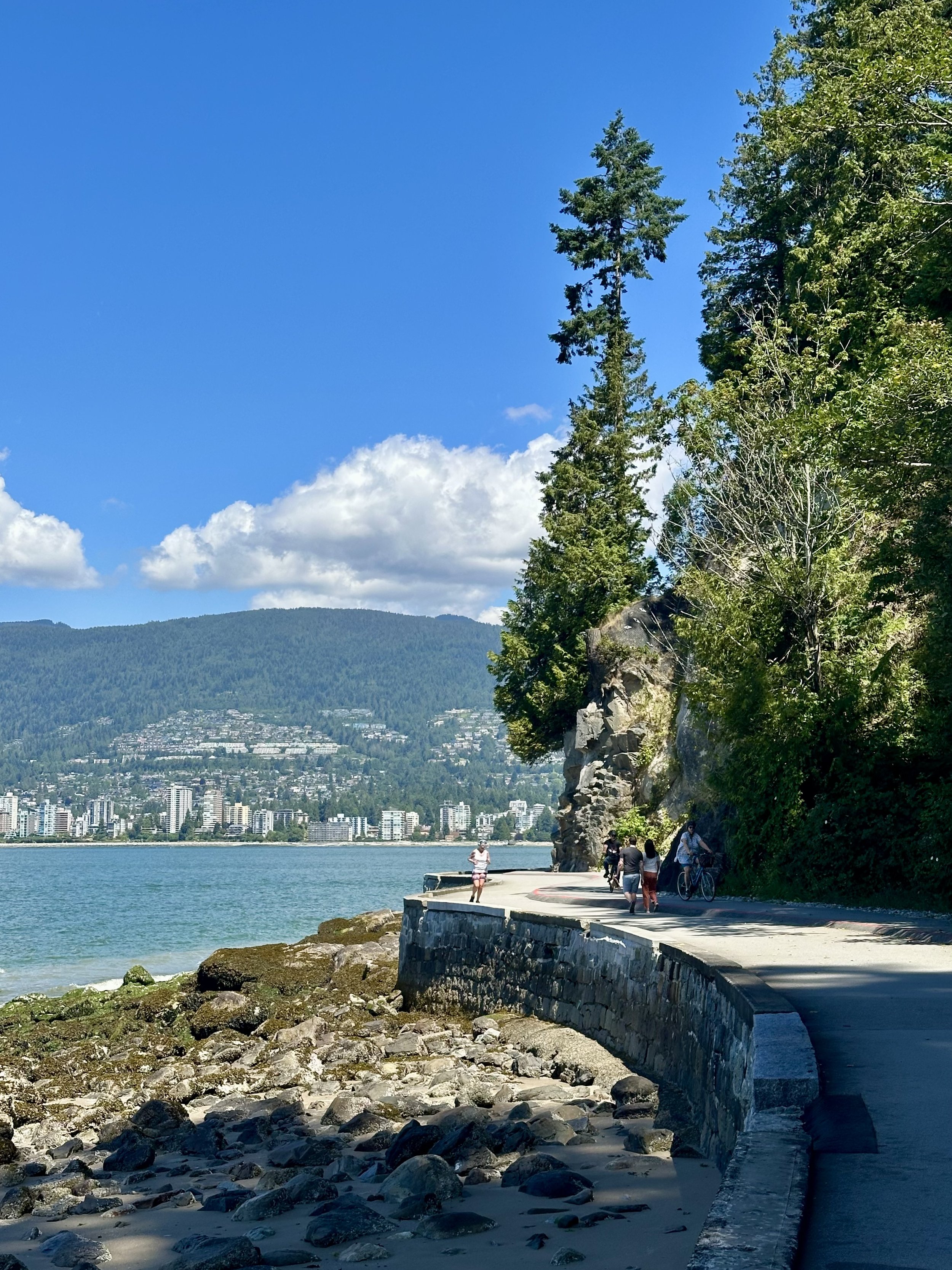
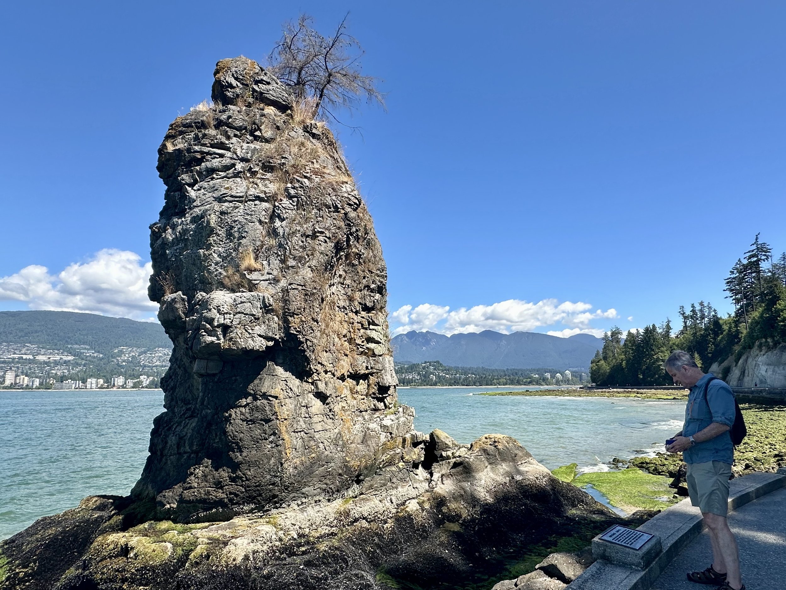
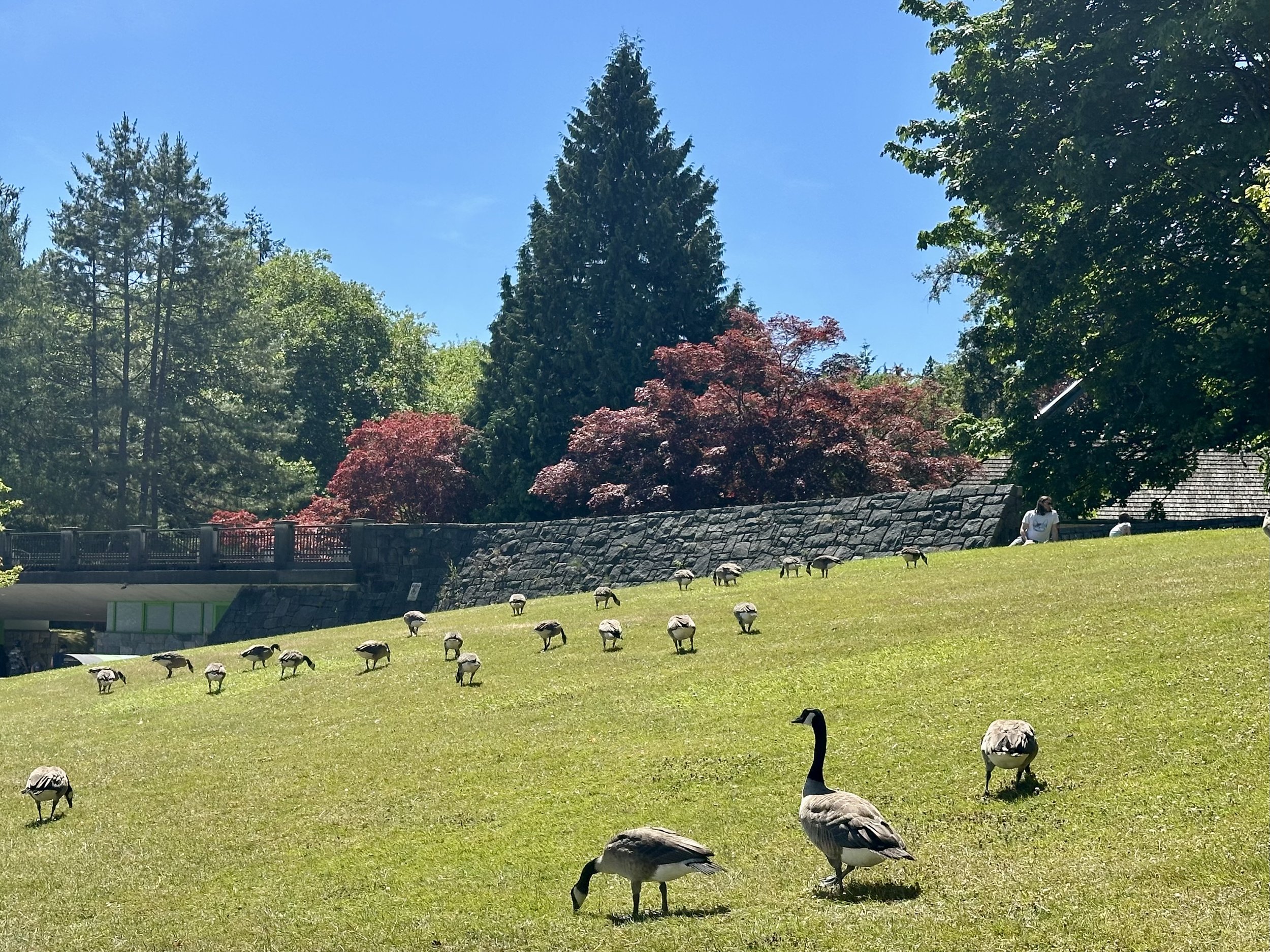
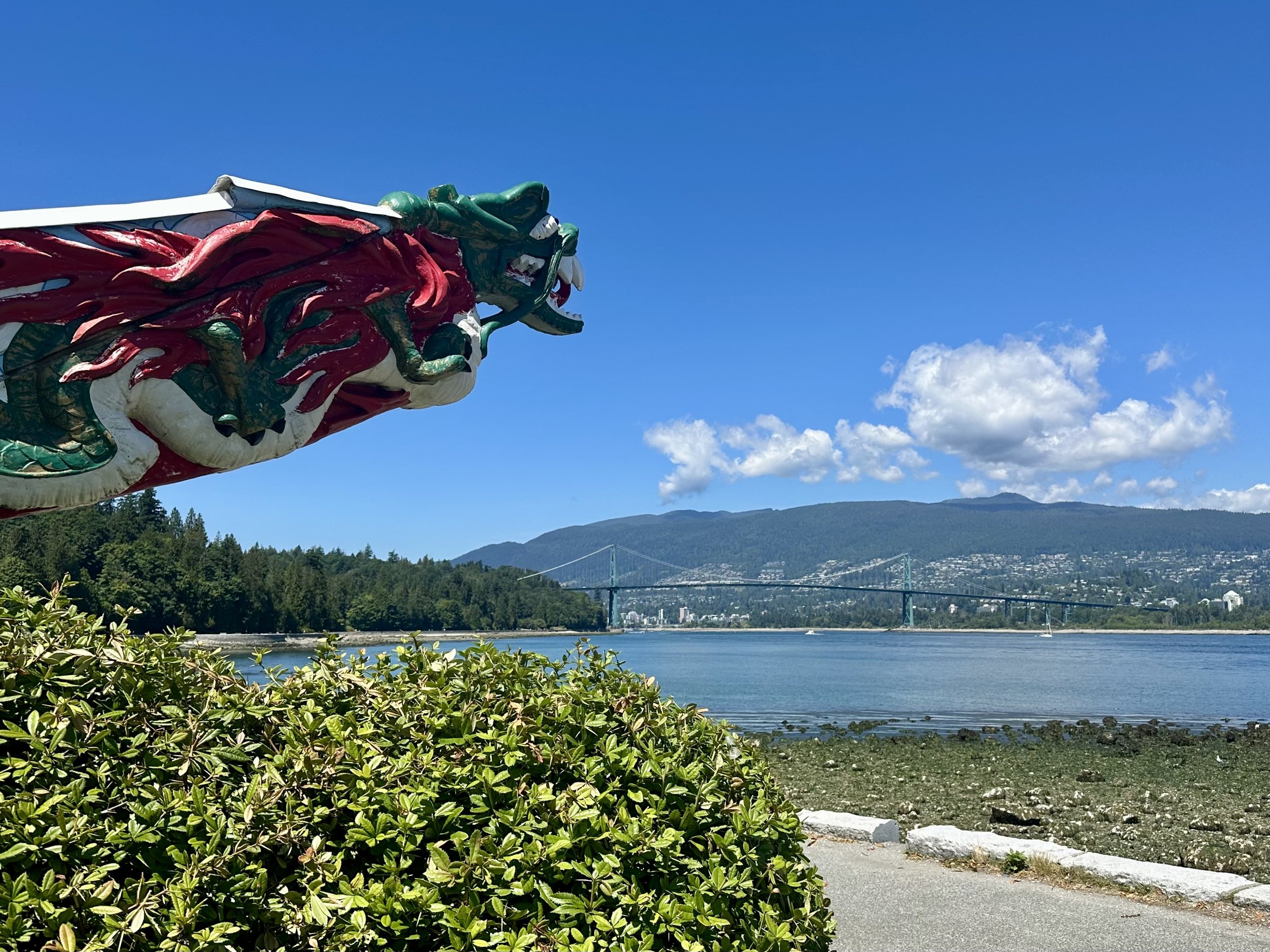
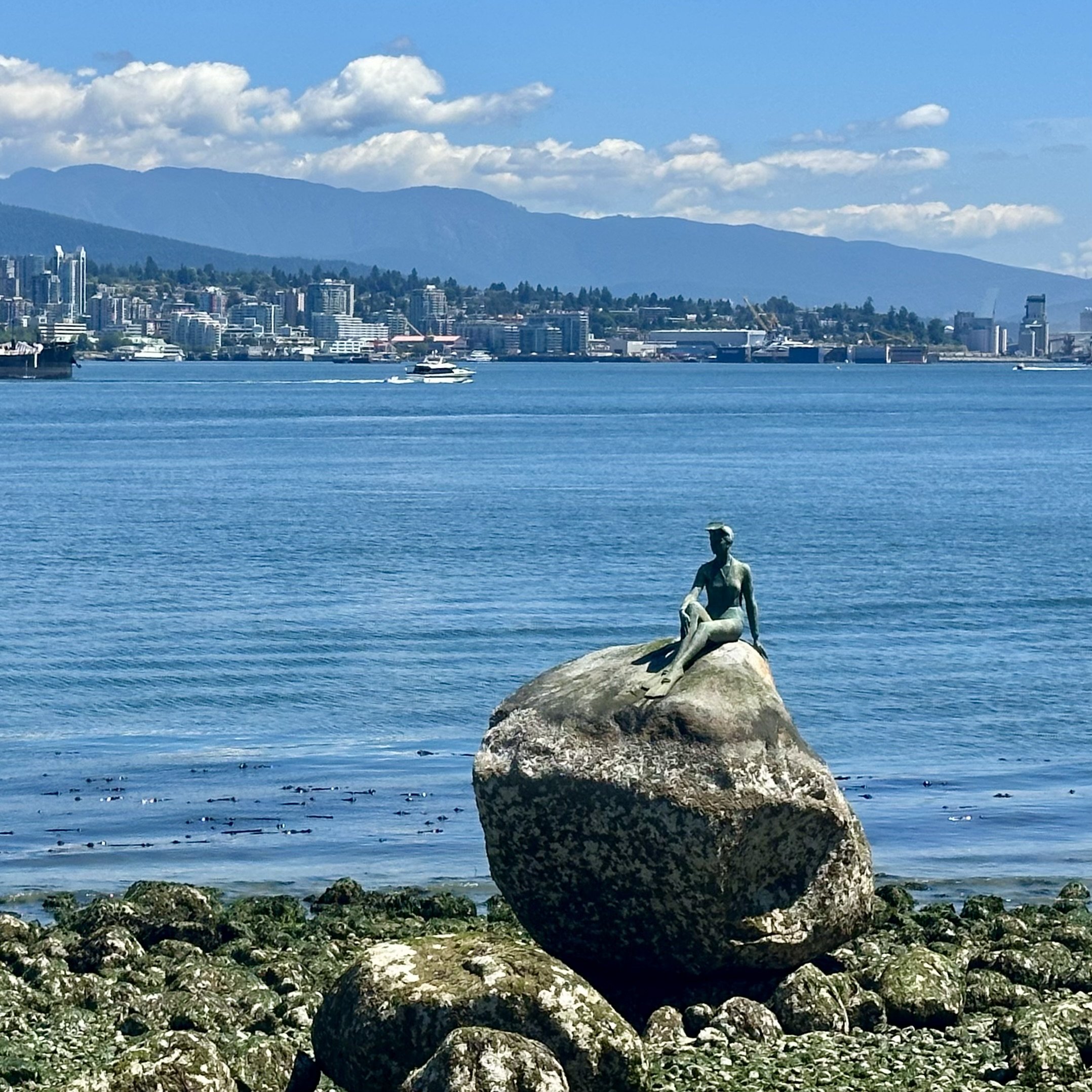
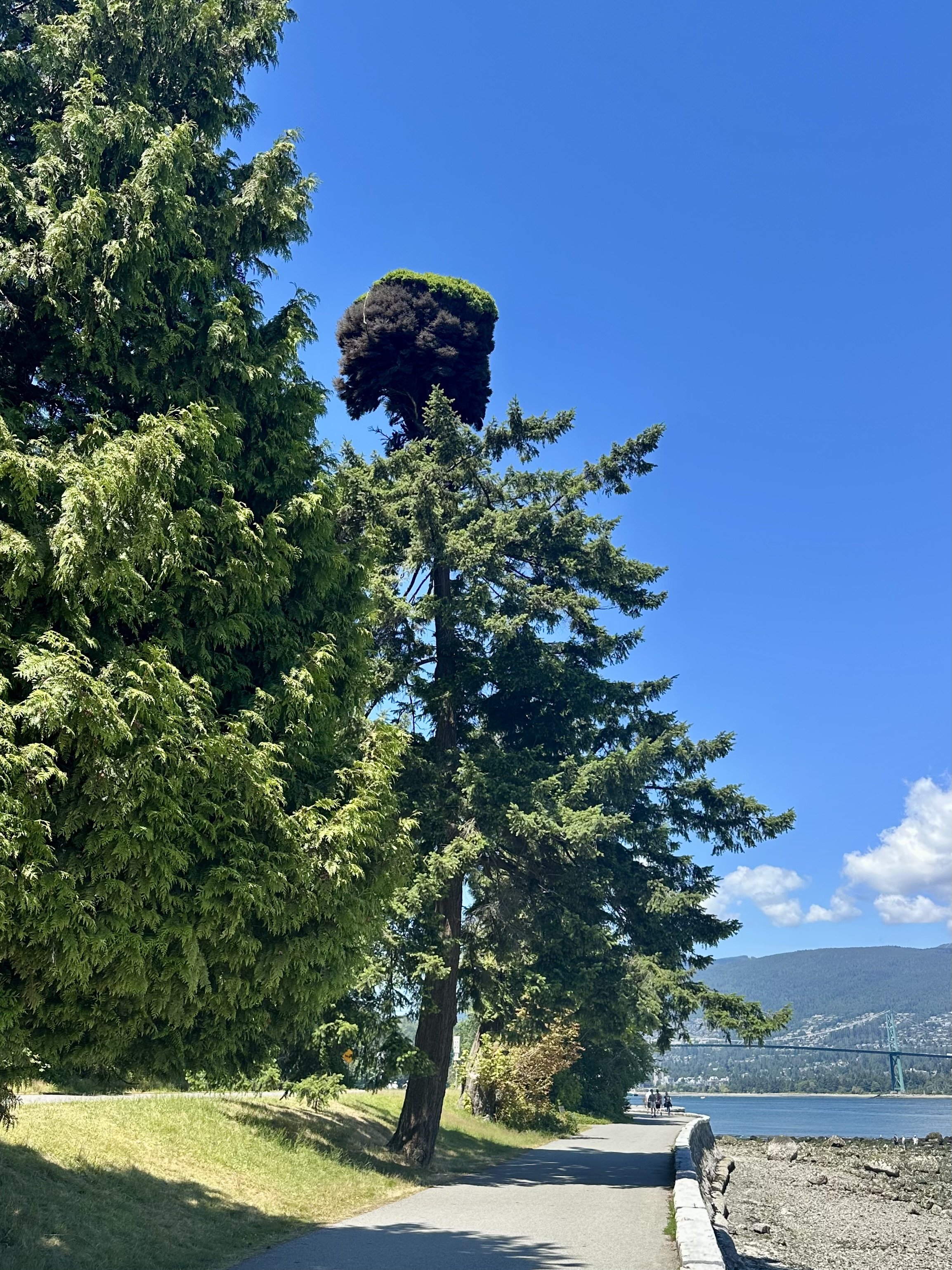
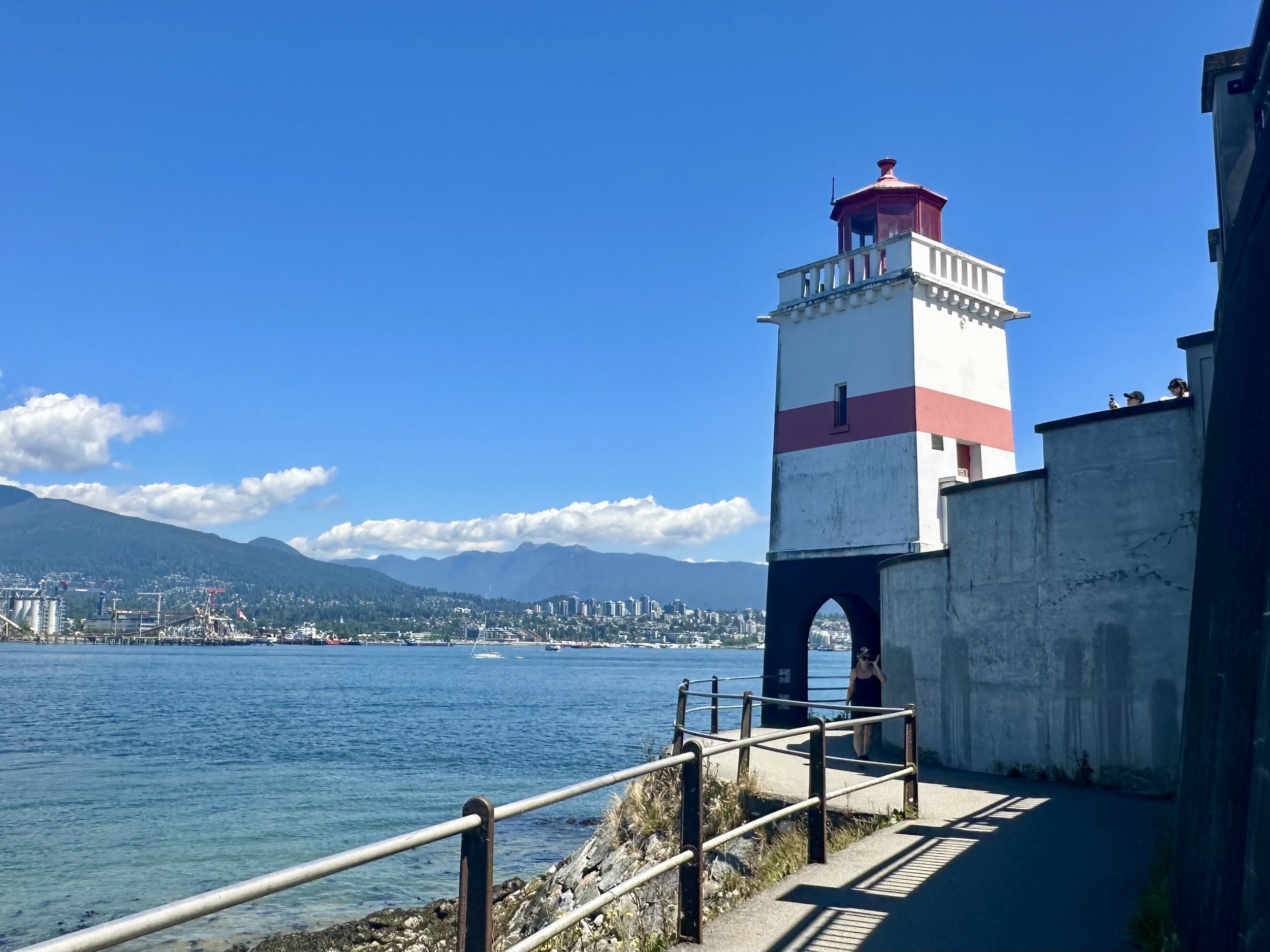
Now the path followed Burrard Inlet, and we were walking eastward, with North Vancouver across the water to our left, and a portion of the Downtown Vancover skyline straight ahead, far in the distance. This section of the path had the figurehead from a transpacific ocean liner that sailed from 1891 to 1922, a 100-year-old lighthouse, and a fir tree topped with a very extreme example of Witch’s Broom (abnormal growth caused by a fungus or mutation). And there were plenty of Canada geese, or perhaps, since we were in Canada they were just “geese.”
We had a great view of the famous Sulphur Pile, a stockpile of purified elemental sulfur at the North Vancouver Sulphur Works. The bright yellow mound has been a familiar sight in Vancouver since the 1980s. Later, I learned that the pile is 10 meters (33 feet) high and contains more than 160 tons of “prill” sulfur, which has the consistency of pea gravel. Prill sulfur is a byproduct of petroleum processing at oil sands in Alberta. It is transported by rail to Vancouver and then exported by ship to China and other parts of Asia for use in manufacturing fertilizer. (Last week our tour guide said the sulfur was used for making fireworks, which sounded much more exciting.)

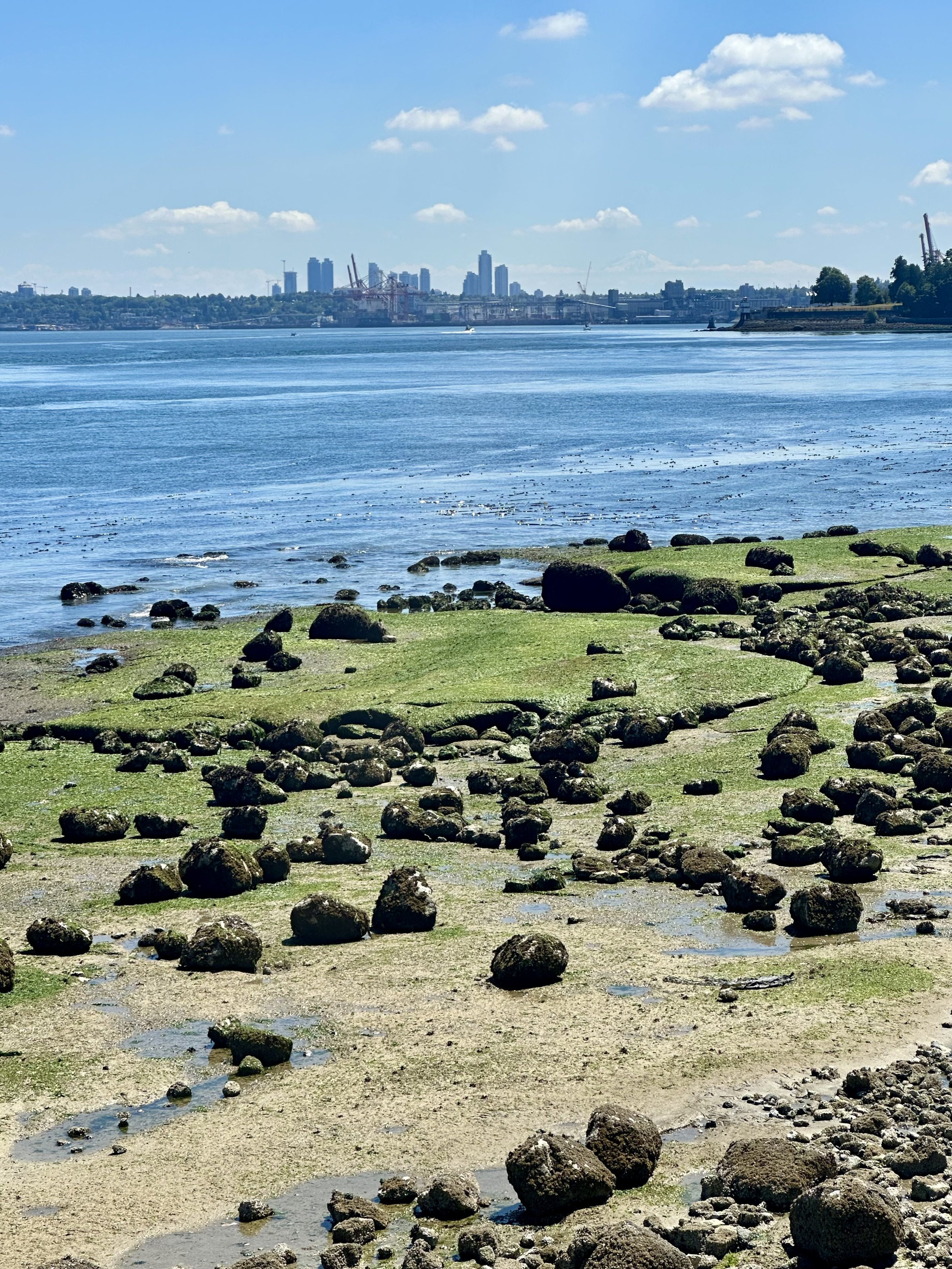
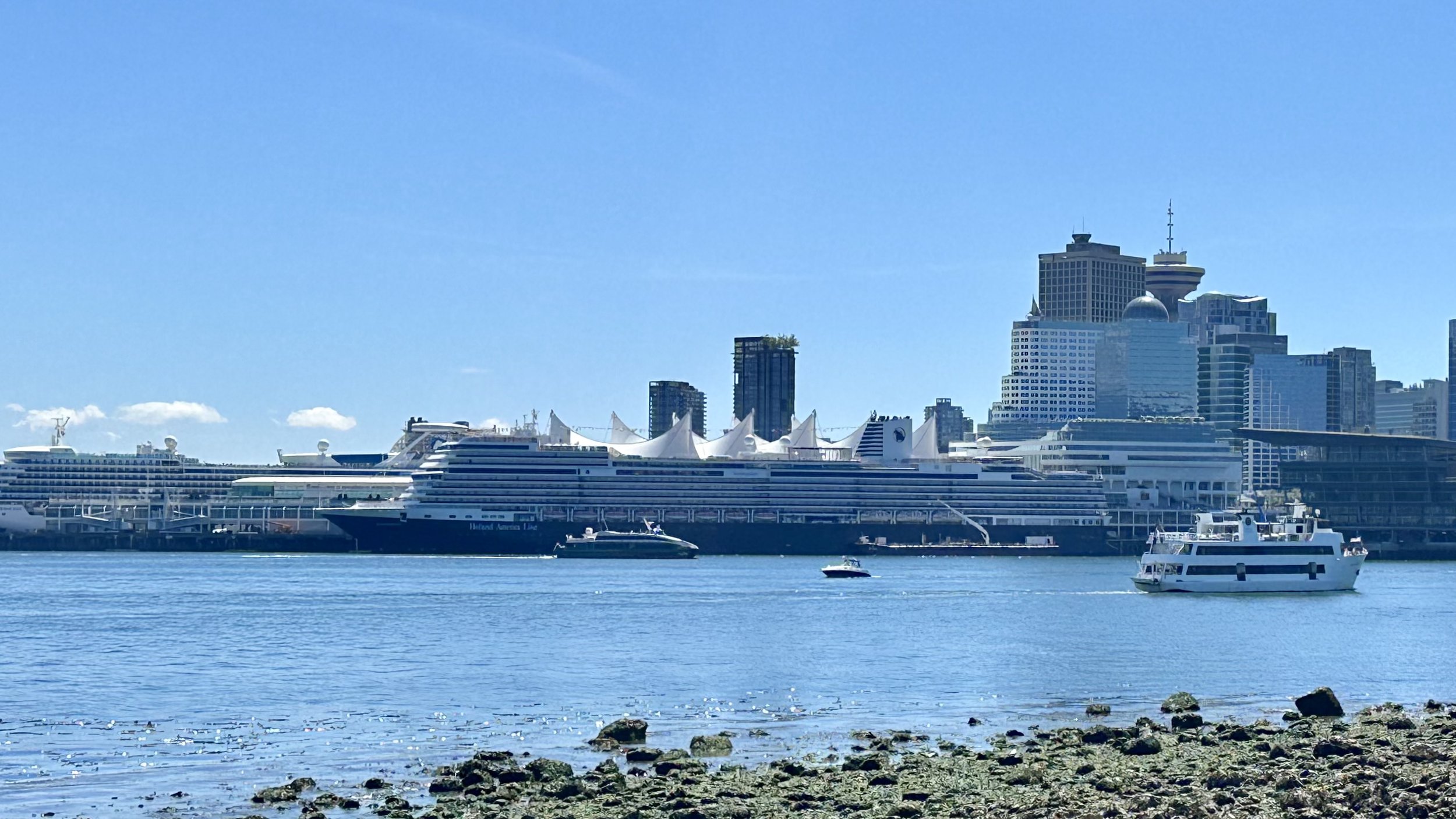
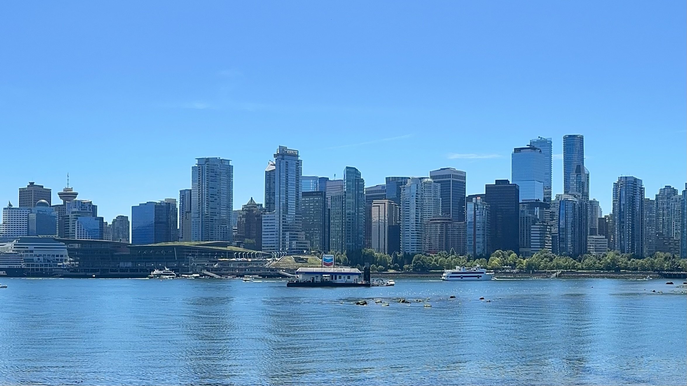
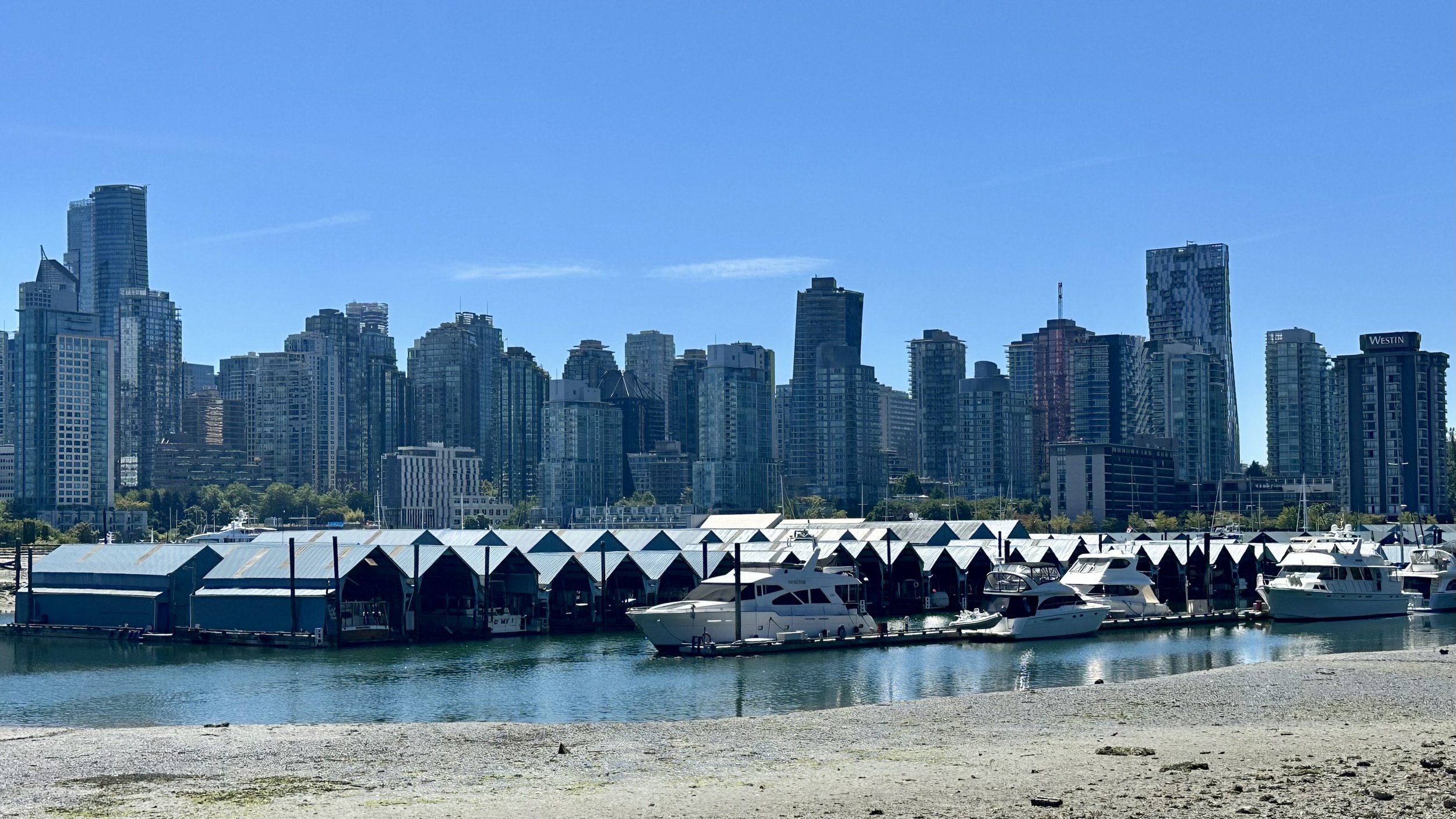
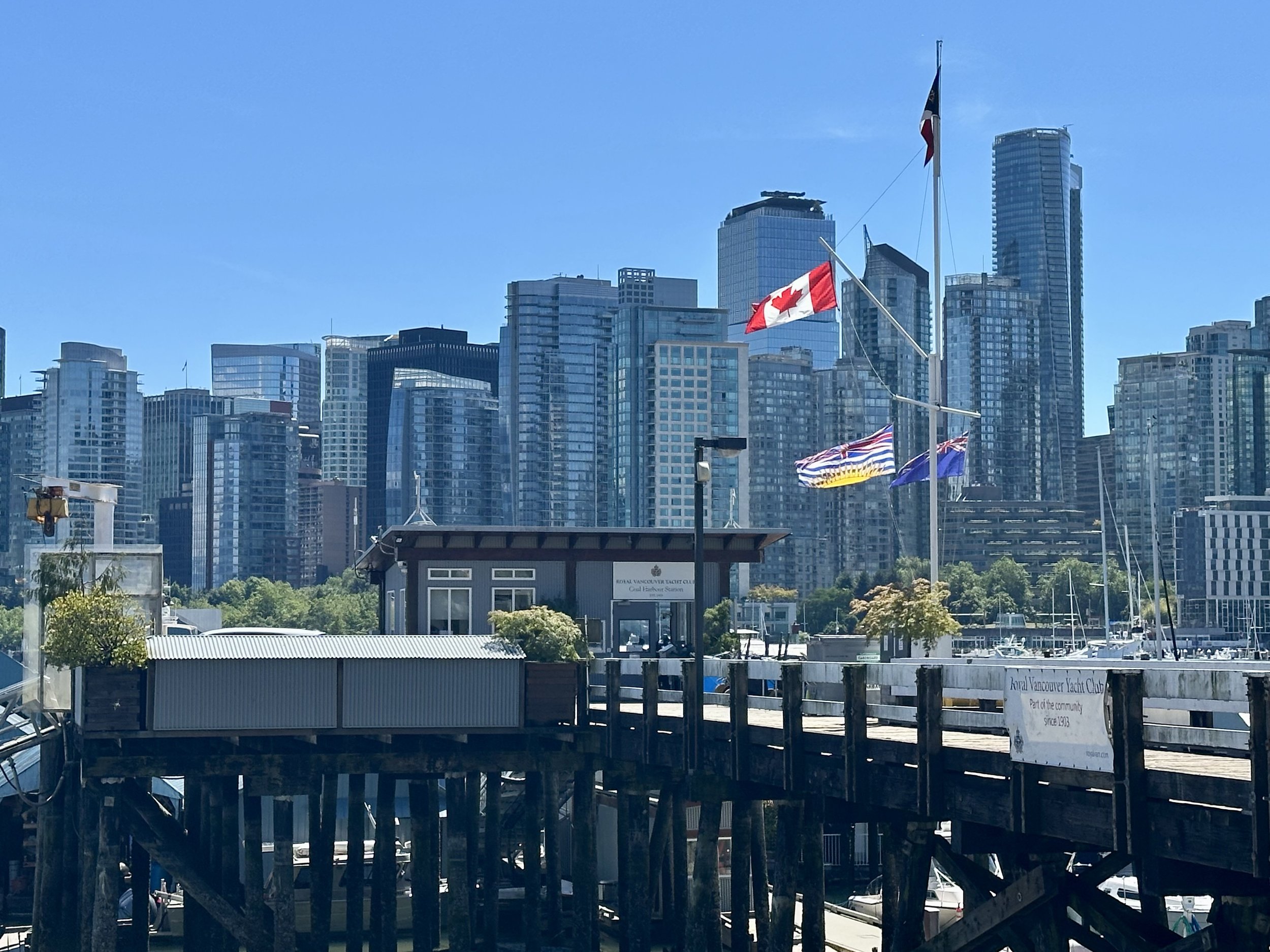
As we neared the edge of Stanley Park, the full length of Downtown Vancouver’s busy skyline came into view, and we could see the cruise ships and the tented roof of Canada Place. The marina at the Royal Vancouver Yacht Club was huge, and it was clear that the boats would be trapped there until high tide.
Finally, we reached the Coal Harbor section of the Seawall, where we had walked on our first day in Vancouver. We left the path here and walked back home, stopping for fresh mango slushies en route. They were deliciously cold, sweet and refreshing, and a welcome reward after our long walk. Final tally: 22,000 steps, about 9 miles, and plenty of sunshine, fresh air, and gorgeous Vancouver scenery.
